Trimble PDLCONF v.4.0.0.24
Advertisement
Description
Instructions for upgrading PDL firmware (also available on page 14 of the PDLCONF User Guide):
- Download the PDL/EDL operating firmware into the directory where PDLCONF/EDLCONF is located. Note that some browsers may not properly download the firmware file. We recommend that you download the zipped version to avoid this problem.
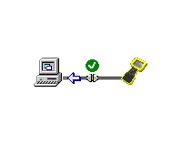
- Connect your PDL to your computer using the programming cable and run PDLCONF/EDLCONF.
- After...
Read more
- Rate:
- Release Date:06/05/2011
- License:Freeware
- Category:Utilities
- Developer:Pacific Crest Corporation
- Downloads:670
- Size:1.67 Mb
- Price: Free
To free download a trial version of Trimble PDLCONF, click here
To visit developer homepage of Trimble PDLCONF, click here
Advertisement
System Requirements
Trimble PDLCONF requires Windows.
Trimble PDLCONF v.4.0.0.24 Copyright
Shareware Junction periodically updates pricing and software information of Trimble PDLCONF v.4.0.0.24 full version from the publisher using pad file and submit from users. Software piracy is theft, Using crack, password, serial numbers, registration codes, key generators, cd key, hacks is illegal and prevent future development of Trimble PDLCONF v.4.0.0.24 Edition. Download links are directly from our publisher sites. Links Trimble PDLCONF v.4.0.0.24 from Bittorrent, mediafire.com, uploadfiles.com, hotfiles.com rapidshare.com, megaupload.com, netload.in, storage.to, depositfiles.com and other files hosting are not allowed. The download file is obtained directly from the publisher, not from any Peer to Peer file sharing applications such as Shareaza, Limewire, Kazaa, Imesh, eDonkey, eMule, Ares, BearShare, Overnet, Morpheus, BitTorrent Azureus and WinMX.
Review This Software
More Trimble PDLCONF Software
Advertisement
Trimble Point Creator Pro 2010 v.4 1
As the construction industry continues to push the utilization of BIM practices for cost savings, overall efficiency, and project data collaboration, Trimble Point Creator Pro fills the need of being able to create 2D and 3D points directly within a
Trimble Construction Manager v.2 5
Trimble Construction Manager provides an intuitive interface that connects assets in the field to decision-makers in the office, making it easy to evaluate construction operations and take action in real-time.
Trimble Data Transfer v.1.55.0.1
The Trimble Data Transfer software transfers data from a range of devices to your PC.
Trimble Planning v.2 90
Put in multiple station locations to determine the best time to observe these stations simultaneously. Get detailed sky plots (including obstructions) of your site for any time of the day to aid in determining the best available occupation times.
GPS Pathfinder Office v.5 20
Powerful and easy to use GPS data processing software The GPS Pathfinder Office software is a powerful and easy-to-use software package of powerful GNSS postprocessing tools, incorporating the new Trimble DeltaPhase differential correction techno
Automatic Remasterer v.1.7.1.1
The main method of program isn't as expected clasic equalization and doesn't change frequency characteristics of sample about some multiple (number of dB) on given band on original, but it independenly on quality and frequency characteristics changes
Pointools POD Creator v.1.0
Convert the broadest range of 3D laser scan formats to the native Pointools POD model format for reuse across all Pointools enabled software.
Pointools Edit v.1 5
Pointools Edit features unique point layer technology for unriveled flexibility and speed for editing point clouds. Layers can be used to segment, clean and recolour huge point cloud datasets.
Avangardo ShapeView v.2.4
Avangardo ShapeView is an ESRI shape files and MapInfo interchange files viewer. Using this utility you can view *.SHP files (ESRI shape files). No *.DBF and *.DBX files are needed. Only polygonal and linear features are supported. Points will not be
Undet - Point cloud processing software for AutoCAD v.1.1
Undet is entry-level point clouds processing software for object analysis, 2D drafting and 3D modeling.
GPSy v.3.40.2
GPSy is a sophisticated Macintosh GPS communications and GIS mapping program.
Other products of this developer Pacific Crest Corporation
ADLCONF v.3. 2. 2135
ADLCONF is a suite of software utilities for con...line of digital communication radios and modems.